
Sherwood ZIP Coverage at a Glance
Five documented postal identities matter when a Sherwood address is searched. Only 72120 is the core street ZIP. The Sherwood ZIP code directory must keep delivery geography separate from municipal geography. A North Little Rock or Jacksonville label can still belong to a parcel inside Sherwood, while a Sherwood post office box does not identify where its user resides.
| ZIP | Areas Covered | Post Office | Notes |
|---|---|---|---|
| 72120 | Core Sherwood, old Sherwood, Sylvan Hills, Kiehl and AR 107 corridor | Sherwood facility, 2300 Wildwood Avenue | Principal Sherwood street ZIP |
| 72124 | Sherwood mailing addresses | PO boxes | Not proof of a street location |
| 72117 | Eastern and southeastern Sherwood near Landers Road | North Little Rock postal identity | Used by Sherwood Public Works |
| 72116 | Southwest and Warden Road boundary area | North Little Rock postal identity | Verify each parcel against the city map |
| 72076 | Gravel Ridge and northern annexation edge cases | Jacksonville postal identity | Postal name may persist after annexation |
This list is not an official ZIP polygon overlay for every census block. No such Sherwood-wide overlay was verified in the research. Treat 72116 and 72076 as address-level cases, not blanket proof that a whole ZIP belongs to Sherwood.
Sherwood's ZIP Identity Arrived Late
Sherwood incorporated in 1948, yet its first post office did not open until 1966. The city received a distinct ZIP from North Little Rock only in the 1990s. That gap is more than local trivia. It changes how older address books, telephone directories, deeds, news notices, and family papers should be searched. A North Little Rock mailing label may be fully accurate for a site now described as Sherwood.
Use time as a search field. Before 1966, test North Little Rock and rural Pulaski County with the street or surname. For later decades, retain both the historic and current labels until a dated source settles the issue. A directory based only on today's ZIP will miss valid older entries.
Note: No source fixed the exact year of Sherwood's ZIP separation more closely than the 1990s, so do not assign a guessed date.
Search Sherwood Residents by ZIP
ZIP is best used as a filter after a name or street gives the search some shape. The Pulaski County property gateway can accept city or ZIP filters in some search tiers, and its core search supports owner, parcel number, property address, subdivision, lot and block, and deed book and page. The map then tests whether the parcel sits inside Sherwood. For voter data, VoterView is an individual self-lookup rather than a ZIP-wide directory. A lawful voter-list request goes through Pulaski Voter Registration.
- Verify the delivery label through the official USPS route or facility record. Keep the full street, city label, and ZIP exactly as returned.
- Search the Pulaski County property records gateway by address or owner. Add ZIP or city only when the available search mode permits it.
- Compare the parcel against the official Sherwood map. The city boundary, not the postal name, answers whether the land is municipal Sherwood.
- For a voter-list research need allowed by Arkansas law, contact Pulaski Voter Registration at its counter or by phone and ask about the available electronic extract.
- Once the ZIP narrows the area, use the Sherwood street directory for the address-by-address parcel and deed workflow.
The voter office is at 401 West Markham in Little Rock's South Lobby, phone 501-340-8336, with posted weekday hours of 8 a.m. to 5 p.m. Arkansas law permits electronic voter lists with names, addresses, precincts, and other election geography, but protected addresses are omitted. This is a request channel, not a public street browser.
Sherwood ZIP Filters Need an Address
The assessor record is an ownership source, not a roll of all residents. It distinguishes the situs address, meaning the physical property being assessed, from the owner's mailing address. A mailing ZIP can point somewhere else. Matching addresses may support owner-occupancy, especially with a homestead indicator, but even then the record does not name every person in the household.
| Field or Mode | Type | Required | How It Helps |
|---|---|---|---|
| Owner Name | Text | One search key | Tests surname, full name, trust, or entity variants |
| Property Address | Text | One search key | Anchors the physical Sherwood parcel |
| Parcel Number | Text | One search key | Uses the exact assessor account identifier |
| Subdivision | Text or dropdown | No | Adds neighborhood context |
| Lot and Block | Paired text | No | Bridges a plat to a street address |
| ZIP or City | Filter | No | Broadens or narrows results when offered by the search tier |
ARCountyData also advertises expanded paid search and reports. The public entry and the assessor counter remain access channels if a ZIP mode is absent or too broad. Record the parcel number and legal description before leaving the result. Those fields survive postal-label changes better than ZIP alone.
72120 Anchors Sherwood ZIP Searches
ZIP 72120 covers the core city, Sylvan Hills, much of the Kiehl Avenue and Arkansas Highway 107 corridor, and most civic facilities. It is the first postal code to try for a present-day Sherwood street address, but it is not the only one. The verified post office facility is at 2300 Wildwood Avenue.
The official Sherwood USPS facility page provides the source view for that location.
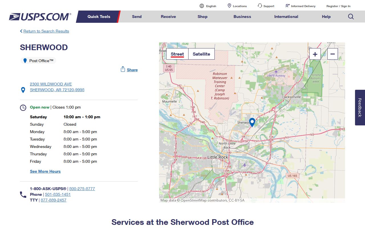
The facility record confirms a postal service point. It does not draw the 72120 boundary or certify that every Sherwood property uses that ZIP. Verify a specific delivery label through USPS, then compare the land parcel and city line.
ZIP 72124 plays a different role. Sherwood's own mailing evidence includes PO Box 6256 with that ZIP. A PO box is a mail-receipt point, not a physical home. When 72124 appears in a directory record, keep the box as a correspondence clue and locate street evidence elsewhere.
Sherwood ZIP Borders Use Other Cities
Eastern Sherwood around Landers Road can use North Little Rock 72117. Sherwood Public Works itself, at 9926 Landers Road, supplies the clearest official example. Southwest parcels near Warden Road may use North Little Rock 72116. Northern sites tied to Gravel Ridge may retain Jacksonville 72076. None of those postal names automatically excludes the address from Sherwood.
Check three identities separately: the USPS delivery city and ZIP, the assessor's situs address, and the municipal boundary shown by the city. If all three match, the answer is simple. If they split, preserve each label with its source instead of replacing one with another. Deeds also carry a legal description, usually subdivision with lot and block or a metes-and-bounds description. That land identity is the strongest bridge across postal change.
Note: ZIP lines route mail; recorded plats, deeds, and municipal boundary data answer different legal and geographic questions.
Sherwood ZIP Lines Are Not Limits
Sherwood's repeated annexations created a city shape that delivery labels do not mirror. Gravel Ridge joined Sherwood in 2008 and nearly doubled the city's land area, yet Jacksonville-oriented postal geography can remain. Older records may correctly say Gravel Ridge or unincorporated Pulaski County. The Trammel Road area entered Sherwood in 1975, producing another era boundary.
The official Sherwood city master map is the cited municipal-map source.
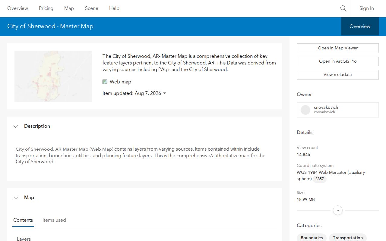
The map supplies current boundary, transportation, imagery, utilities, land-use, and hazard context. It does not replace a deed or recorded plat as legal title evidence. Use it to decide whether a postal edge address appears inside the current city, then retain the parcel and legal-description references for the official land trail.
Planning and address questions can also go to Sherwood Engineering, Permits & Planning at 31 Shelby Road, 501-835-4753, during posted weekday hours of 7:30 a.m. to 4:30 p.m. That office may resolve a city address or conflicting street name. Unincorporated Pulaski County address questions follow the county addressing channel at 501-340-8271.
Read Sherwood ZIP Terms Correctly
Postal terms describe mail delivery, while assessor and deed terms describe land. Keeping those systems apart prevents a common ZIP code directory error: treating one field as if it answered every location question.
- Postal ZIP
- A USPS delivery territory. It is not a Sherwood city-limit line.
- ZIP+4
- A ZIP with four added digits that narrows delivery to a smaller segment, building, or group of boxes.
- PO-box ZIP
- A ZIP used for post office boxes. It identifies where mail is received, not a person's street address.
- Unique ZIP
- A code assigned to one large organization or destination. No unique Sherwood ZIP was verified in the research.
- Carrier route
- A delivery path used by postal carriers. It can cross boundaries that matter to other public records.
- Situs address
- The physical address of the assessed parcel, distinct from the owner's mailing address.
Sherwood also numbers buildings by local ordinance. One number is assigned per 25 feet of street frontage, with odd numbers on south and west sides and even numbers on north and east sides. Separate entrances for separate occupants may receive separate numbers. Planning may change conflicting street or subdivision names, which is another reason to preserve a parcel number and legal description beside the ZIP.